1. Dams History:
Early dam building took place in Mesopotamia and the Middle East. Dams were used to control the water level, for Mesopotamia's weather affected the Tigris and Euphrates rivers. The earliest known dam is the Jawa Dam in Jordan, 100 kilometres (62 mi) northeast of the capital Amman. This gravity dam featured an originally 9-metre-high (30 ft) and 1 m-wide (3.3 ft) stone wall, supported by a 50 m-wide (160 ft) earth rampart. The structure is dated to 3000 BC. More details
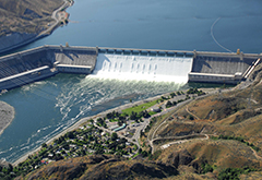
2. Grand Coulee Dam:
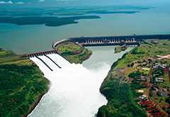
3. Itaipu Dam:
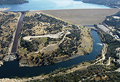
4. Oroville Dam:
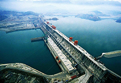
5. Three Gorges Dam:
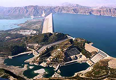
6. Tarbela Dam:
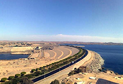
7. Aswan High Dam:
The Aswan High Dam is an embankment dam built across the Nile in Aswan, Egypt, between 1960 and 1970. Its significance largely eclipsed the previous Aswan Low Dam initially completed in 1902 downstream. Based on the success of the Low Dam, then at its maximum utilization, construction of the High Dam became a key objective of the government following the Egyptian Revolution of 1952; with its ability to control flooding better, provide increased water storage for irrigation and generate hydroelectricity the dam was seen as pivotal to Egypt's planned industrialization. Like the earlier implementation, the High Dam has had a significant effect on the economy and culture of Egypt. More details
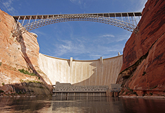
8. Glen Canyon Dam:
9. Gavins Point Dam:
Gavins Point Dam is a large embankment rolled-earth and chalk-fill dam on the Missouri River located in both Nebraska and South Dakota in the Upper Midwest Region of the United States. The dam and hydroelectric power plant were constructed as the Gavins Point Project from 1952 to 1957 by the United States Army Corps of Engineers. The dam creates the 31,400 acre (12,700 ha) Lewis and Clark Lake and is located approximately 4 miles west (6.4 km) (upstream) of Yankton, South Dakota. More details
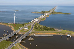
The Afsluitdijk is a major causeway in the Netherlands, constructed between 1927 and 1932 and running from Den Oever on Wieringen in North Holland province, to the village of Zurich in Friesland province, over a length of 32 kilometres (20 mi) and a width of 90 metres (300 ft), at an initial height of 7.25 metres (23.8 ft) above sea level. It is a fundamental part of the larger Zuiderzee Works, damming off the Zuiderzee, a salt water inlet of the North Sea, and turning it into the fresh water lake of the IJsselmeer. The Afsluitdijk was the initial demonstration site for a 130 km/h (81 mph) speed limit in the Netherlands. More details
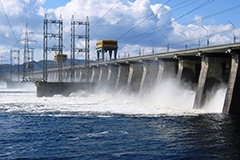
11. Zhiguli Dam:
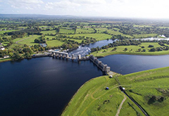
12. Shannon Dam:
13. Taum Sauk Upper Reservoir:
14. Fort Peck Dam:
15. Hoover Dam:
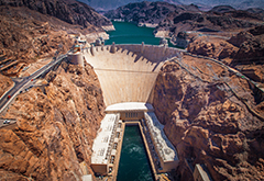
Hoover Dam, once known as Boulder Dam, is a concrete arch-gravity dam in the Black Canyon of the Colorado River, on the border between the U.S. states of Arizona and Nevada. The Dam was constructed between 1931 and 1936 during the Great Depression and was dedicated on September 30, 1935, by President Franklin D. Roosevelt. Its construction was the result of a massive effort involving thousands of workers, and cost over one hundred lives. The dam was controversially named after President Herbert Hoover. More details
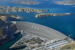
16. Atatürk Dam:
16. Atatürk Dam:
The Atatürk Dam (Atatürk Barajı), originally the Karababa Dam, is a zoned rock-fill dam with a central core on the Euphrates River on the border of Adıyaman Province and Şanlıurfa Province in the Southeastern Anatolia Region of Turkey. Built both to generate electricity and to irrigate the plains in the region, it was renamed in honour of Mustafa Kemal Atatürk (1881–1938), the founder of the Turkish Republic. The construction began in 1983 and was completed in 1990. The dam and the hydroelectric power plant, which went into service after the upfilling of the reservoir was completed in 1992, are operated by the State Hydraulic Works (DSİ). More details
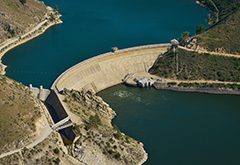
17. Arrowrock Dam:
Arrowrock Dam is a concrete arch dam on the Boise River, in the U.S. state of Idaho. It opened in 1915 and is located on the border between Boise County and Elmore County, upstream of the Lucky Peak Dam and reservoir. The spillway elevation for Arrowrock is 3,219 feet (981 m) above sea level and its primary purpose is to provide irrigation water for agriculture. In 1910, the Reclamation Service began to consider another storage facility farther east on the Boise River. After several surveys, engineers decided upon the Arrowrock site which had previously been the site of a private irrigation venture under the direction of Arthur De Wint Foote yet failed for lack of funding. More details
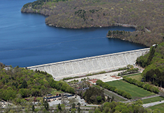
18. Kensico Dam:
The Kensico Reservoir is a reservoir located in the towns of Armonk (North Castle) and Valhalla (Mount Pleasant), New York. It was formed by the old earth and gravel dam, built in 1885, which impounded waters from the Bronx and Byram rivers, and supplied about 18 million gallons daily. The construction of a new masonry dam in 1915, replaced the old dam, and expanded the water supply by bringing water from the Catskill Mountains over a distance of more than 100 miles. It is about 3 miles (5 km) north of downtown White Plains, New York, and about 15 miles (24 km) north of New York City. The reservoir serves mainly to store the waters received from the Catskill Mountains west of the Hudson River. More details
19. Marmot Dam:
The Bull Run Hydroelectric Project was a Portland General Electric (PGE) development in the Sandy River basin in the U.S. state of Oregon. Originally built between 1908 and 1912 near the town of Bull Run, it supplied hydroelectric power for the Portland area for nearly a century, until it was removed in 2007 and 2008. The project used a system of canals, tunnels, wood box flumes and diversion dams to feed a remote storage reservoir and powerhouse. The entire project was removed because of rising environmental costs. Marmot Dam on the Sandy River was demolished in 2007, and the Little Sandy Dam on the Little Sandy River was taken down in 2008. More details
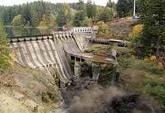
20. Condit Dam:
Condit Hydroelectric Project was a development on the White Salmon River in the U.S. state of Washington. It was completed in 1913 to provide electrical power for local industry and is listed in the National Register of Historic Places as an engineering and architecture landmark. PacifiCorp decommissioned the project due to rising environmental costs, and the dam was intentionally breached on October 26, 2011. Condit Dam was the largest dam ever removed in the United States until the Elwha Ecosystem Restoration Project on the Olympic Peninsula removed the larger Elwha Dam and Glines Canyon Dams. The White Salmon is a glacier-fed river originating on the slopes of Mount Adams and emptying into the Columbia River. More details
17. Arrowrock Dam:
18. Kensico Dam:
19. Marmot Dam:
20. Condit Dam:

